RealityMaps: ski, hike, bike
Ultra realistic 3D map with route planner, offline sat nav & GPS tracker
Download
App Info
Rating
Everyone
Release
Jun 25, 2013
Last Update
New Feature: Avalanche bulletins and current avalanche situation in 3D
Genre
Maps & Navigation
About
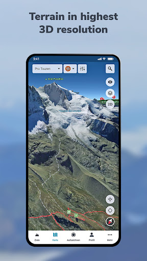
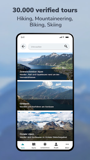
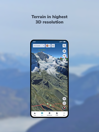
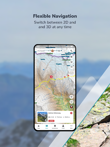
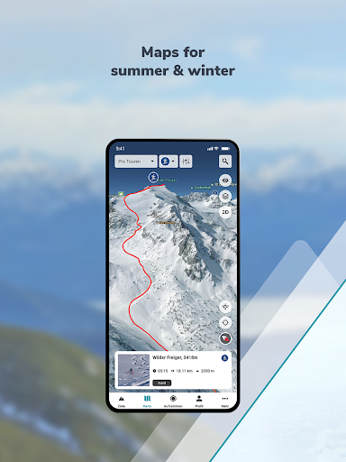
RealityMaps Hiking Bike MTB Best 3D map for challenging outdoor experiences, 3D route planner & tracking Are you ready for unique outdoor experiences and exciting new places? The RealityMaps app is your perfect companion for challenging adventures – with the most accurate 3D map of all apps. We create our realistic 3D map from aerial and satellite images using innovative technology. This allows you to accurately assess the terrain and plan your tour with confidence. Be inspired by over 30,000 verified tours for hiking, biking, mountaineering, or skiing – in Europe's most beautiful mountain regions. Or plan your own routes directly in the 3D map, even off the beaten track. Additional map information on hiking and biking trails, as well as slope gradient and orientation, will help you with your planning. The app also offers GPS tracking, GPX import, offline maps, and access to more than 5,000 webcams showing current conditions. VERIFIED TOUR VARIETY The app offers exclusively hiking, mountain, ski, and bike tours from Bergverlag Rother and other partners, thoroughly researched by experts. With the GPS, you can easily follow the marked routes of the tours. DETAILED MAP MATERIAL A topographical map in 2D and 3D complements the 3D map. Additional map layers provide information on hiking and cycling trails, as well as slope gradients and slope orientation. GREATER SAFETY The app offers the highest level of safety. The 3D map allows you to see the steepness and condition of the terrain and identify potential hazards. The resolution of the 3D map is so good that you can orient yourself even in bad weather, in fog, or at night. GPS TRACKING GPS tracking transforms your smartphone into a fully-fledged navigation device. While on tour, your current location is always displayed live on the 3D map. PLANNING TOURS With the routing function, you can plan your own routes directly on the 3D map or the topographic map. You can plan routes along existing paths or a route through pathless terrain to discover unique places. RECORD AND SHARE YOUR TOURS With GPS tracking, you can record tours and view the route you've taken live on the 3D map. Duration, distance, elevation, and speed are continuously recorded. Create your personal user account to save the recorded tracks, transfer your tracks to other smartphones or tablets, and share them with friends. IMPORTING TOURS AS GPX For unlimited tour variety, you can import tours in GPX format or from Komoot into the 3D map. This puts the entire world of hiking, biking, and mountain tours from the internet at your fingertips. MAPS FOR SUMMER & WINTER Global coverage with satellite images. High-resolution 3D map for the entire Alps and Pyrenees (summer & winter), as well as for other selected mountain regions in Europe (summer only). OFFLINE MAPS Important for your safety: download selected regions of the 3D map on your smartphone for use without an internet connection. Try PRO features free for 7 days with no obligation. Register and try all PRO features free for one week. - Detailed tour descriptions - Unlimited tour recording, saving, sharing, and transferring to other devices - All map layers (2D and 3D, aerial photography and topographic maps, hiking and cycling trails, slope gradient and slope orientation) - Save the 3D map to your smartphone for offline use - Plan tours in 3D - Automatically synchronize self-recorded, planned, and imported tours between the app and the web tour planner
Gallery


Contacts
https://www.realitymaps.app
Reviews
Felix Brecht
have been using it since the death of Fatmap. great UI. customer service is very responsive. and now with the latest update, weather , snow depth, winter satellite data got added. GAME CHANGER for us winter athletes. the high res imagery are 2nd to none, though only available for some regions in the Alps. I hope this is soon extended to all of the Alps!!! kudos
Alberto De Giuli
As a professional mountain guide, I find the 3D map very detailed and useful especially for winter tours. You can easily find your way around in the Dolomites, and dream / plan your new lines just studying the 3D map. I just love it!
Shakil Rahman
It's load for ever
Louis D'introno
amazing app , easy to use and a lot of useful free features ! import , create and export GPX freely is what I was looking for !
Cody Johnson
Denali maps?
Cynthia Johnson
This is stupid and a waste of my time. I was hoping I would be able to explore Mount Everest and other mountains without actually having to go there. I live in the USA and don't have the means to travel but all I want to do is just look at pictures and explore the trails on my device.
جلات خان عيسی خيل کور
nice
hasnat iftikhar
SMART
Andrej Zupančič
The 3D views of the terrain can be very useful and help considerably in planning your outings. So, this aspect could possibly earn the app even a 5-star rating. But, it's terribly annoying to see established, local Slovenian place names written in German. That probably makes the use of this app harder, as nowadays not many Slovenes could help you if you are looking for "Mitterdorf", for instance. But, the developers responded really quickly to my gripes and acknowledged the poblem, so, kudos!
Ettore Rasca
Really great! Winter satellite map is not complete, but still this is the best Fatmap alternative currently available.
Steve Watts
Good so far but i can't get the winter option to show winter maps and ski runs. Is that a premium thing?